Get the lay of the land
- Columbia River Gorge National Scenic Area: stretches 85 miles and includes portions of three Oregon and three Washington counties.
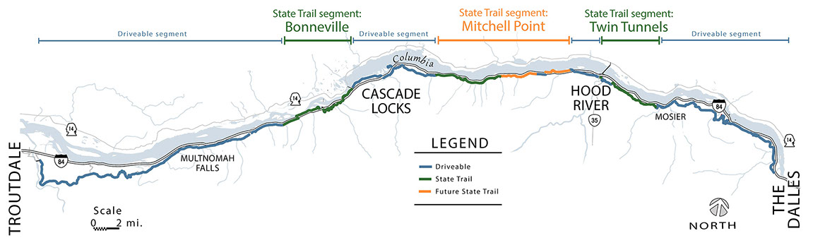
- HCRH = Historic Columbia River Highway and Trail: America's first scenic highway, construction from 1916 to 1922; In 1986 ODOT began a restoration of the 1916 Highway that includes Three Trails which are Car Free.
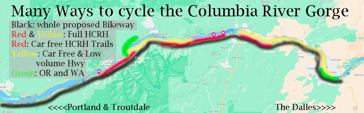
- Proposed Oregon Columbia River Scenic Bikeway: Larger vision of all Roads & Trails for cycling that includes All Bodies All Bikes. Future inclusion of both Washington and Oregon expected per a regional Columbia River Gorge Bikeway
- Maps & Lists below
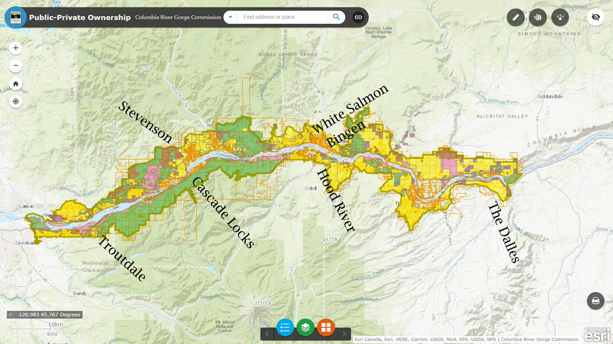
1. Columbia River Gorge National Scenic Area
4. I-84 Exit Numbers
7. Rest Rooms along I-84 in the Gorge & Waterfalls
2. Entire Bird's Eye View: HCRH
5. Bikable Portions of HCRH
8. Four Ecological Gorge Regions
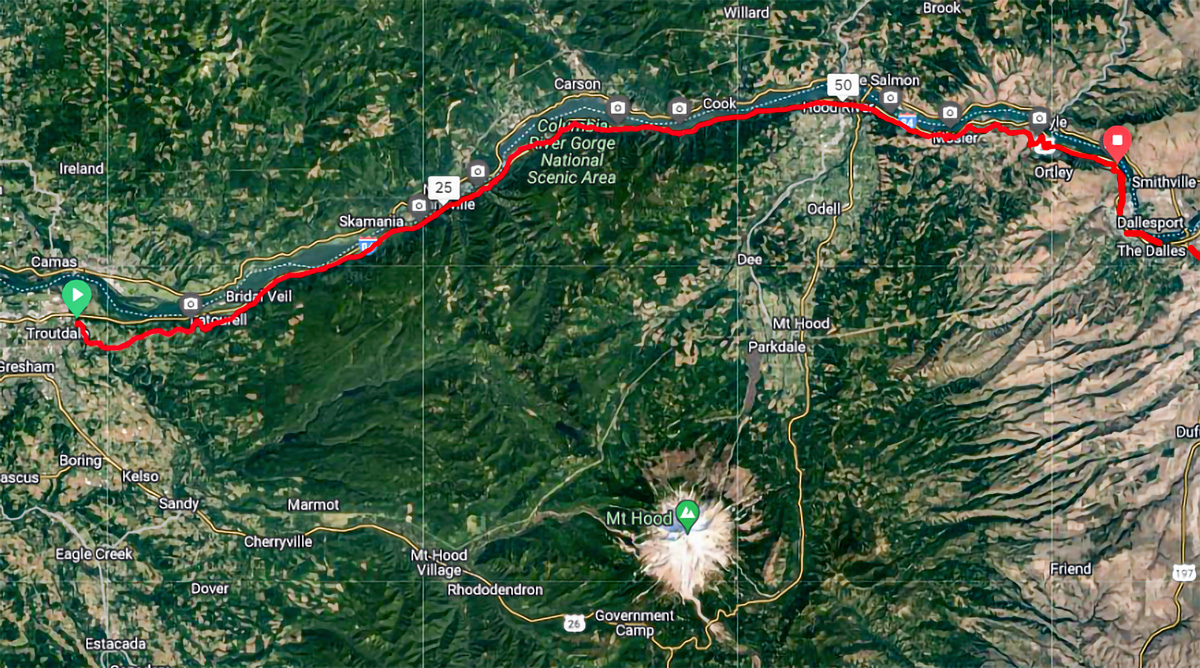
3. Bike trips within the Columbia River Gorge
6. Three Car Free Cycling along the HCRH
9. Historic Columbia River Highway & Amenities
Columbia River Gorge National Scenic Area
Entire Historic Columbia River Highway & Trail Area

Drivable and Bikable Portions of the Historic Columbia River Highway
from Troutdale to The Dalles, Oregon.
Bike Car Free on Bonneville, Mitchell (Wyeth to Viento), and Twin Tunnels Trail Segment.
Go on Car Free Cycling/Pedestrian Paths
 Lovely Introduction to cycling in the Gorge
  Wide dramatic Columbia River Gorge Views
 Covered tree canopy, sun drenched & a Tunnel
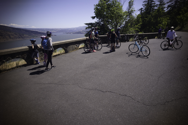 Lovely Introduction to cycling in the Gorge
 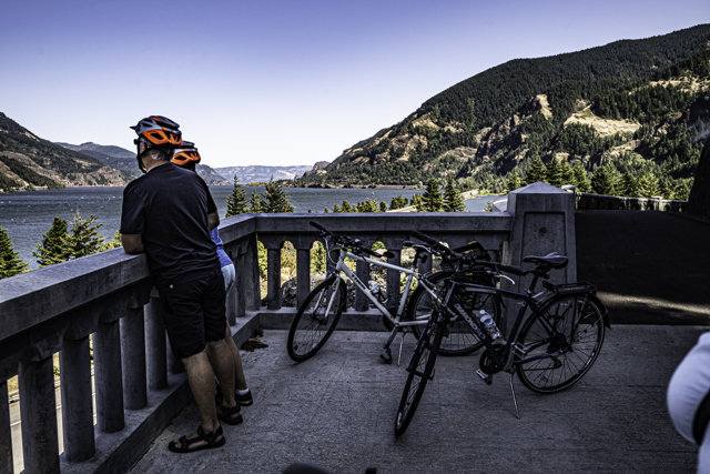 Wide dramatic Columbia River Gorge Views
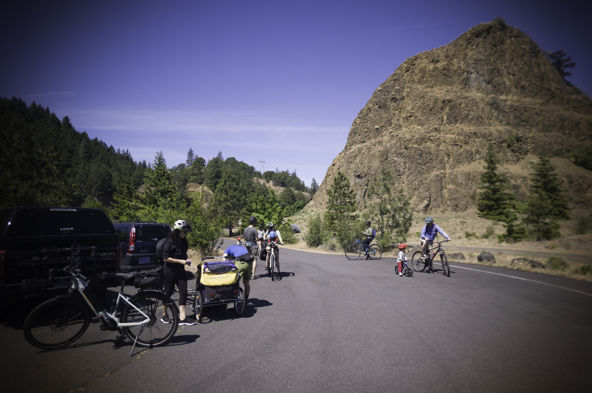 Covered tree canopy, sun drenched & a Tunnel
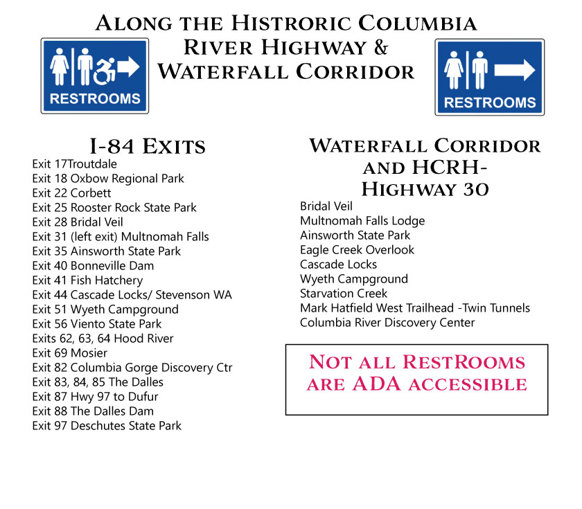
Restrooms & Waterfalls on the Oregon side of the Columbia River

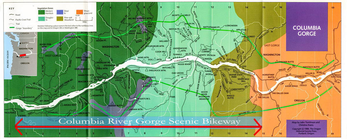
Below is the Ecological Map of Gorge Region by Russ Jolley
The four regions are
Western Hemlock, Douglas Fir, Silver Fir, and Pine Oak Woodland
Map is from Russ Jolley's Wildflowers of the Columbia Gorge (with Jack Murdock). style="text-align: center"
This book is a delight to follow the the flowers' arrivals during the whole year along the Gorge.
King of the Highways, constructed 1916-1922
Western HCRH Road
Middle HCRH Road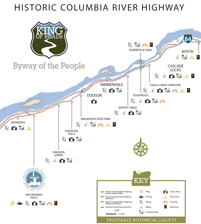
Eastern HCRH Road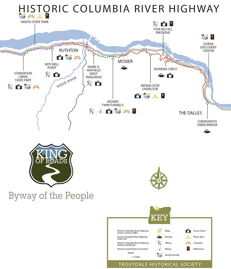
Questions: info@gorgepedal.com Website copyrighted: Gorgepedal.com